No products in the cart.
Gps Marks Sydney Harbor offshore Reef Snapper Fishing Spot Land based Locations
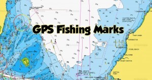
Gps Fishing Marks Sydney Harbor Offshore Reef Spots & Location Browse the Area you would like to fish and target the desired Fish type . which include of fish include : Snapper , Kingfish , Squid , Marlin, Tuna , Bream , Mulloway , Jew , Reef fish , Mullet, Trevally Tailor , Bonito , Flathead land based
Latitude S Longitude E Datum
Broken Bay Wide Reef – 33.31.42 151.25.07
Halfway -33 31.891 151 25.726
33 32.70 151 23.20
33 33.00 151 23.80
33 33.10 151 26.40
North of Broken Bay.- 33 31.962 151 25.690
Fishing – Leather jacket, Bream, Tarwhine,
Jewfish. Water depth 42 yard.
Gravel bottom.
More Gps Marks Bellow
Offshore Bottom Bouncing & Flathead Setups Rigs
Offshore Bottom Bouncing & Flathead Setups Rigs
Snapper – Water depth 50 fathoms. 33 32.121 151 24.890 Reef Bottom .
Big Reds 33 32.117 151 25.043
Maitland Bay East Reef 33.32.126 151.23.743
West Reef Snapper, Tailor, Bream. 33.32.221 151.22.114
Maitland Bay Bombora 33.32.240 151.23.760
Bonito, Tailor. Water depth 33.32.92 151.23.99
19m rising from 28m. Reef
bottom.
Gps Marks Below.
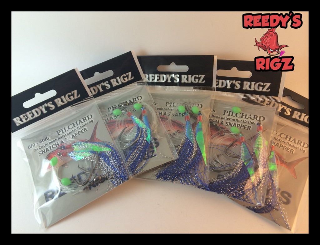
Reedy’s Rigz 10 Pre Made Snapper Snatcher Fishing Rigs Free Shipping

Gps Marks Sydney Fishing Spots New South Wales Harbour bay
Sydney gps fishing marks # Eden gps marks .# Tathra gps marks . Bermagui gps marks . # Narooma gps marks . #Tuross Head gps mark . # Bateman’s Bay gps marks . # Jervis Bay bay gps marks # Shoalhaven gps marks Kiama gps marks . # Wollongong gps marks . # Gosford/Terrigal gps marks .
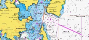
See Google maps below – click on your state to find GPS marks or fishing spots near you. Expand map in the top right corner from your desktop/tablet/laptop, and zoom in on your area or place your visiting to find fishing spots and related information. if you would like to share fishing spots or tips and tricks in a particular area email us at admin@snapperfishingtackle.com with the either the GPS mark or information and location details together with any photos you wish to be displayed. Over time more GPS marks will be added.
Broken Bay Offshore 33.32.292 151.24.427
30-36M Ground 33 32.400 151 24.900
West Reef N 33 32.492 151 22.386
Midway Reef Hawkesbury Entrance. – 33.32.700 151.23.200
Blue Groper East Reef Close Snapper, Yellowtail Kingfish, 33 32.809 151 24.094 WGS84
Bonito, Tailor, Reef fish. Water depth 21 – 30m. Rock reef . East Reef Snapper, Morwong, Trevally, 33.32.900 151.23.910
Kingfish Reef bottom.
33 32.900 151 23.880
33 32.900 151 23.833
33 33.091 151 24.111
Hons Spot Mulloway Reef bottom – 33.33.00 151.21.00
Midway Reef – 33.33.00 151.23.80
30m Pinnacles. – 33.33.100 151.24.420
East Reef Wide – 33.33.080 151.24.380
-33.33.560 151.24.030
Broken Bay 33 33.197 151 24.373
33.33.20 151.22.30
33.33.00 151.23.8
33 32.29 151 24.42
33.32.29 151 24.43
Box Head 33.33.200 151.20.600
West Reef Snapper, Trevally, Reef Species. -33.33.250 151.22.170
Water depth 12 – 16m.
Reef bottom.
Snapper, Morwong, Trevally, 33.33.273 151.22.054
Kingfish, Mulloway. Reef bottom.
West Reef S 33 33.289 151 22.344
Reef species. 33.33.436 151.22.190 WGS84
Snapper, Mulloway. 33.33.440 151.22.190
Water depth 50 – 60m.
East Reef North Snapper, Morwong, Trevally, 33.33.650 151.24.060
Kingfish. Reef bottom.
Whiting Whispera Flasher Rig

The Bottles North of Box Head. Snapper, 33.34.00 151.23.84
Morwong, Mulloway, Kingfish,
Australian Salmon, Pike.
Reef & gravel bottom.
Flathead Grounds Flathead. 33 34.164 151 26.744
33 33.069 151 28.069
Flint & Steel 33.34.294 151.17.124
Old FAD Tuna, Dolphin Fish. 33.34.442 151.36.101 WGS84
Flat bottom. Water depth 60
fathoms.
Valiant Wreck Sand bottom. Pelagics & reef 33 34.701 151 20.711
species.
Kingfish, Snapper. 33.34.713 151.20.725
Bream, Kingfish. Water depth 33.34.71 151.20.73 AUS66
26 – 29m. Sand bottom with
wreck.
33 34.729 151 20.849
Kingfish, Reef species, Snapper, 33.34.793 151.20.657
Morwong. Water depth 6m. Gravel
bottom.
33 34.800 151 20.666
33 34.816 151 20.670
Water depth 20-26m. Sand & reef 33.34.840 151.20.700
bottom. Snapper, Morwong,
Kingfish, Trevally, Mulloway.
NE Broken Bay Dolphinfish, Tuna, Kingfish. 33 34.737 151 32.178
Water depth 80m. Broken reef
bottom.
Broken Bat Inner Reef 33.34.780 151.30.430
Barrenjoey 20m Wreck 33.34.838 151.20.694
Brok.Bay Wide Fishtrap Snapper, Morwong, Trevally, 33.34.855 151.31.773
Kingfish. Reef bottom.
Lousy 33 34.892 151 21.741
Barrenjoey Fix is eatern shore, Small reef 33.34.900 151.20.100
extends SE for 500m. Tideline
shows from fix across reef on
runout, small peak at 9m drops
to sand at 15m. Fish dropoff
into 15m from bombora on nth
side.
Broken Bay Wide Main 33 35.018 151 31.633
Broken Bay Wide Marlin, Shark, Kingfish, Reef 33.35.050 151.31.810
species. Reef bottom.
33 31.879 151 31.879
33 34.595 151 31.499
33 35.005 151 31.081
Scar Flathead. Sand & gravel bottom. 33 35.100 151 26.000 WGS84
Water depth 50m.
Broken Bay Wide SW Dropoff 33 35.162 151 31.504
Broken Bay Wide E Dropoff. Snapper, Morwong, 33 35.162 151 31.810 WGS84
Kingfish, Mulloway, Teraglin.
Trawleys Reef Snapper, Trevally, Morwong, 33.35.560 151.20.750 WGS84
Mulloway.
Broken reef with sand.
Water depth 28-30m.
Kingfish, reef species. 33 35 618 151 21 182 WGS84
Mulloway, Yellowtail Kingfish, 33 35.951 151 21.091
Snapper.
Water depth 28 – 30m.
Trawleys 33.35.593 151.20.760
Reef Species. Reef bottom. 33 36.026 151 21.025 WGS84
33 36.222 151 20.977
33 35.590 151 20.760
Mixed reef. 33.36.184 151.21.014 WGS84
33 36.593 151 20.760
33 35.059 151 20.076
Palm Beach Kingfish, Bream, Morwong. 33.35.971 151.21.029 WGS84
Reef bottom. Water depth 20 –
25m.
Broken Bay Traps Pelagics. 33 36.018 151 31.499 WGS84
33.36.018 151.31.450 WGS84
Broken Bay Wide Marlin, Shark, Kingfish, 33 36′ 28″ 151 25′ 30″
Snapper, Morwong, Tevally, 33 36.028 151 25.030 WGS84
Dolphin Fish. 33 35 005 151 31.081 WGS84
33.35.050 151.31.810
33.21.02 151.45.96
Traps Dolphinfish. 33 36.01 151 31.49
Boltons Reef Bonito. Snapper, Morwong, 33 36.471 151 22.399 WGS84
Flathead. Water depth 28 – 35m.
Gravel, sand, reef bottom.
Snapper, Flathead, Reef fish. 33.36.600 151.22.255
Water depth 62m. Sand patches.
Kingfish, Yellowfin Tuna. 33.36.632 151.22.106
Snapper. reef species. Reef 33 36.396 151 22.145 WGS84
bottom.
33 36.060 151 22.026
33 36.600 151 22.260
Snapper, Morwong. 33 36 632 151 22 106
33 36.649 151 22.229
33 36.677 151 22.233
Whale Beach 33 36.800 151 21.350
Whale Beach 42m Water deoth 42m. 33 36.800 151 22.300
Reggies Snapper, Mulloway. 33 37.954 151 21.682 WGS84
33 37.967 151 21.500
33 37.484 151 22.097
Snapper, Morwong. 33 38 256 151 21 948
Avalon Gutter Snapper, Mulloway, Kingfish, 33.38.120 151.21.400 WGS84
Morwong, Reef Species.
Off Avalon Beach. Water depth
34m. Reef bottom.
Birchgrove Park Wreck – Nannygai, Snapper, 33.38.270 151.22.400
Morwong. Water depth 46m.
33 38.027 151 22.040
33 38.433 151 20.600
33 38.12 151 21.40
Reggies Snapper Snapper 33 38.501 151 21.752
33 38.241 151 21.786
Reggies Snapper II Snapper 33 38.656 151 21.330
Daniels Mark Snapper, Mulloway, Shark, 33.38.835 151.31.769
Morwong. Water depth 80m.
Glasshouse Shark, Snapper, Mulloway. 33.39.020 151.21.100
Maco Shark, Kingfish. 33.39.27 151.23.40
Water depth 50m. Sand & broken
bottom.
Reddie Run Snapper. Gravel bottom. 33.39.500 151.21.000
Esmeralda Reef Snapper, Morwong, Trevally, 33.39.528 151.25.643
Kingfish. Reef bottom.
Snapper, Morwong, Teraglin, 33 39 670 151 25 180
Leatherjacket. Water depth 67m.
Broken reef, sand, gravel bottom.
Snapper, reef species. 33 39.451 151 25.234 WGS84
33.39.700 151.25.193
33 39.700 151 25.190
33 39.702 151 25.201
Tuna Hole 33.39.560 152.01.650
Newport Flathead. Rock bottom. 33.39.598 151.20.234
Esmeralda Close 33 39.640 151 24.604
Pelagic & reef species. 33 39.700 151 25.193 WGS84
Esmeralda Wide Shark, Marlin, Snapper, 33 39.765 151 25.958
Kingfish, Dolphinfish, Striped
Tuna. Water depth 50 fathoms.
Reef bottom.
Newport Reef 33 39.800 151 20.150
Bungan Head Water depth 50m. 33 40.320 151 21.850
Bungan Wide Snapper, Mulloway. 33 40 510 151 20 711 WGS84
Water depth 32 – 40m. Hard reef
on mud bottom.
Close In Snapper Snapper 33 40.527 151 20.821
33 33.44 151 22.19
33 36.060 151 22.026
33 38.027 151 22.040
33 43.068 151 21.41
33 46.11 151 19.41
Dave’s Reef Snapper, Muloway, Reef species. 33 40.900 151 20.25
Water depth 30 fathoms.
Jewhole Shark, Mulloway, Teraglin, Bream 33.41.570 151.20.150
Narrabeen Wreck 33.43.000 151.21.000
33.43.040 151.20.780
Snapper, Shark, Nannygai, 33.43.090 151.20.570 WGS84
Teraglin.
Long Reef Wreck Wreck. Water depth 42m. 33.43.086 151.20.943 WGS84
Ship Reef Mulloway, Snapper, Yellowtail 33 43.100 151 20.600 WGS84
Kingfish, Trevally.
Wrecks, gravel & sand bottom.
Water depth 45-50m.
Long Reef Blue Building Snapper, Mulloway. 33.43.678 151.21.409
33 43.68 151 21.40
Long Reef Snapper, Flathead, Mulloway, 33.43.68 151.21.41
Groper, Morwong, Reef fish.
Water depth 22 – 36m.
33.45.147 151.21.707
33.47.500 151.26.000
Long Reef Wall Rock & boulders rising to shelf. 33.44.37 151.19.60 AUS66
Water depth 26 – 8m.
Caution in swell.
Long Reef Close Snapper, Kingfish. 33.44.409 151.19.677 AUS84
Water depth 21m. Reef bottom.
Blue Metal Grounds 33.44.49 151.49.888
33 44.490 151 49.890
Good Property Snapper, Mulloway. 33 44 51 151 21 98
Broken reef & gravel. Water
depth 55m.
Long Reef Wide Shark, Snapper, Yellowfin Tuna, 33.44.550 151.22.550
Trevally, Morwong.
Water depth 60m.
Marlin, Shark, Kingfish, 33.44.550 151.22.100
Mulloway, Snapper, Teraglin.
Reef bottom.
33.45.56 151.22.22
Pelagics. 33’58.199 151’18.558
Collaroy Wide 33.45.710 151.22.680
Two Lights 33.46.000 151.24.140
Grant’s Snapper Snapper. Water depth 50m. 33.46.11 151.19.41 WGS66
Iggy’s Spot Snapper, Morwong. Water depth 33.46.111 151.19.407 WGS84
25m. Reef bottom.
Waverider Bouy 33.46.14 151.24.56 WGS84
Dee Why Headland Snapper, Jew, Morwong, Flathead 33.46.24 151.21.30
40 – 50m,
Sandy bottom, between reef
Wave Ryda 33.46.380 151.24.970
Two Lights Reef bottom. Water depth 80m. 33.46.550 151.24.140
Old Dee Why Snapper, Bream, Shark. 33.46.590 151.19.400
Dee Why Wide Marlin, Shark, Pelagic, Snapper 33.46.590 151.21.000
Morwong, Bream.
2 Bouys Snapper, Kingfish, Bonito, 33.46.730 151.20.372 AGD84
Morwong. Water depth 51m.
Sand & gravel bottom.
Tripod 33.46.910 151.22.600
Foul Grounds Snapper, Leatherjacket, 33 46.930 151 21.025
Kingfish, Traglin.
Bobs Spot Morwong, Snapper. 33.46.96 151.57.47 WGS84
Location: Sydney II
Description Comments Latitude S Longitude E Datum
Whale 33.47.070 151.22.480
Tuna, Marlin, Shark, Mulloway 33.47.000 151.22.550
Teraglin, Snapper.
33 47.007 151 22.250
Reds 33.47.151 151.18.631
3 Bouys North Snapper, Kingfish, Bonito, 33.47.449 151.20.987 AGD84
Morwong. Water depth 50m.
Sand & gravel bottom.
Murphy’ 33.47.490 151.22.040
Morwong, Trevally, Yellowtail 33.47.600 151.22.100
Kingfish.
Long Reef Snapper, Yellowtail Kingfish, 33.47.500 151.26.000
Mulloway.
Trap 60M 33.47.530 151.22.700
Queenscliff Reef 33 47.575 151 17.725
Bluefish Yellowtail Kingfish, Snapper, 33 48 05 151 21 34
Mulloway. Reef bottom.
Water depth 20 – 32m.
3 Bouys Snapper, Kingfish, Bonito, 33.48.095 151.20.832 AGD84
Morwong. Water depth 51m.
Sand & gravel bottom.
Trap 33.48.150 151.21.780
The Colours Kingfish, Snapper, Sweep, 33.49.600 151.19.450
Flathead, Gurnard, Morwong,
Surface pelagics.
Water depth 40-50m.
Nods 33.49.930 151.19.290
Sydney Heads Snapper, Sweep, Flathead, 33.50.00 151.18.00
Morwong, Gurnard, Mulloway.
Water depth 43m.
South Head Wreck Flathead, Snapper, Bream, 33.50.215 151.17.238
Trevally. Water depth 25m.
Wreck & sand bottom.
Sow and Pigs Reef Snapper, Bream, Kingfish, 33.50.320 151.16.180
Trevally. Reef.
Obelisk Tuna, Marlin, Shark, Bream, 33.50.48 151.19.220
Snapper, Pelagics.
Gladesville Bridge Paramatta River. Mulloway. 33 50.515 151 08.750
Sand & rock bottom.
Water depth 19-23m.
The Leads Snapper, Reef species. 33.50.78 151.19.91
33.50.74 151.20.74
The Gap Bream, Sea Perch, Old Wife. 33.50.79 151.17.20
Water depth 25 – 40m.
Sydney Heads 33.51.000 151.18.000
33.50.320 151.17.410
Kookaburra Wreck Nannygai, Yellowtail. 33.51.1 151.20.9
Wreck with sandy bottom.
Water depth 76m.
BH_9M Morwong, Snapper, Flathead. 33.51.764 151.26.689
Water depth 115m. Gravel &
sand bottom.
Thommos 33.51.802 151.20.462
Annie Millar Wreck – Nannygai, Yellowtail 33.52.000 151.17.360 WGS84
Kingfish, Snapper. Depth 45m.
Wreck & sand bottom.
Kingfish, Mulloway, Trevally. 33.52.12 151.17.87 AUS66
Water depth 42 – 44m. Sand
bottom with wreck.
Pines #2 Snapper, Morwong, Trevally. 33.53.735 151.20.053 WGS84
HMAS Encounter Wreck – Snapper, Nannygai. 33.54.600 151.20.900 WGS84
Depth 75m. Sand bottom.
Reef Kingfish, Perch, Trevally. 33.55.30 151.28.55
Reef bottom. Water depth 124m.
Nobby’s Head Reef 33.55.325 151.47.967
Big Red 33.55.360 151.24.760
Wedding Cake Island Yellowtail Kingfish, baitfish. 33.55.544 151.16.082
12 Mile Reef Tuna, Marlin, Shark, Pelagic, 33.55.660 151.28.510 WGS84
Perch, Snapper. Reef bottom.
33 56′ 40″ 151 28′ 41″
33.55.510 151.28.340
Reef fish. Rocky bottom. 33.55.510 151.28.650
Water depth 60m.
Reef bottom. 33.56.400 151.28.410 WGS84
Trag Grounds Mulloway, Snapper, Trevally. 33.56.070 151.16.440 WGS84
Water depth 25 – 30m. Reef
bottom.
Big Steve’s Spot Yellowtail Kingfish, Trevally, 33.56.760 151.21.650
Yellowfin Tuna, Snapper, Marlin.
Reef bottom.
Tank 1km off Coogee Beach. Teraglin, 33.57.610 151.17.78 WGS84
Mulloway. Reef bottom.
Water depth 75m.
Snapper. Reef bottom. 33.57.66 151.17.66
Water depth 71m.
FAD Dolphin Fish. 33.57.90 151.54.46 WGS84
Water depth 182m.
Party Boat Reef bottom. Water depth 80m. 33.57.984 151.18.735 WGS84
MV Mallabar Wreck. Mulloway, Tiger Shark, 33 58.13 151 15.43
Kingfish. Water depth 9 – 13m.
Southeast Reef Reef bottom. Water depth 64m. 33.58.169 151.20.775 WGS84
The Grave Snapper, Pigfish, Morwong, 33.58.200 151.27.530
Flathead. Gravel bottom.
Third Runway Snapper, Bream, Flathead, Tailor.33.58.376 151.11.784 WGS84
Water depth 15m. Sand bottom.
Pines South Morwong, Snapper, Yellowtail 33.58.56 151.22
Kingfish. Reef bottom.
Maroubra Peak Drop Off. Snapper, Morwong, 33.58.58 151.21.78 WGS84
Kingfish.
Peak No.1 Kingfish, Snapper, Mulloway, 33.58.582 151.21.703
Morwong, surface pelagics.
Water depth 65m. Reef bottom.
Fish Traps Reef bottom. Water depth 120m. 33.58.608 151.23.013 WGS84
Waynes Spot Sydney Heads. Morwong. 33.58.700 151.21.370
59mtr Peak 33.58.700 151.21.570
The Peak Tuna, Marlin, Shark, Pelagic, 33.58.760 151.21.650 WGS84
Kingfish, Snapper, Mulloway. 33 55′ 00″ 151 21′ 15″
Reef bottom. 33.58.750 151.22.610
Water depth 65m. 33’58.749 151’21.634
Water depth 65 – 100m. 33.58.54 151.21.57
Reef bottom. Water depth 65m. 33.58.800 151.21.500 WGS84
Bare Island Bommie Botany Bay. Snapper, Mulloway. 33.59.771 151.13.833 WGS84
Water depth 7.5m. Reef bottom.
Kookaburra Wreck – Nannygai, Yellowtail, 33.91.100 151.20.900
Leatherjacket. Depth 75m.
Dumping Grounds Numerous wrecks centered at, 34.00 151.36
+/- 500m 33.47 151.21
33.03 152.27
Jew Nose Botany Bay. Flathead, 34.00.026 151.13.823 WGS84
Blue Swimmer Crab.
Water depth 3m. Sand & weed
bottom.
Watts Reef Reef bottom. Water depth 5m. 34.00.023 151.13.021 WGS84
Sand & reef/rock bottom. 34.00.080 151.11.300
Bream, Jewfish, Flathead. 34 00.083 151 11.303
Hot Water Sand bottom. Water depth 3m. 34.00.243 151.12.566 WGS84
Botany Bay Heads 34.00.257 151.14.265
9F Peak Yellowtail Kingfish, Sergeant 34.00.62 151.14.06 AGD66
Baker.
Gary’s Spot 34.00.985 151.04.504
Botany Bay Blue Morwong, Nannygai, Snapper. 34 01.504 151 04.449
Water depth 60m.
Mountains Reef Marlin, Yellowfin Tuna. 34.01.55 151.25.61
Last Ditch Water depth 32m. Reef bottom. 34.01.768 151.13.861 WGS84
Woronora River Flathead. 34 01.793 151 02.393
Near footbridge at mouth of
Forbes Creek. Water depth 2.5m.
Sandy bottom.
Browns Mountain Marlin, Tuna, Shark, reef fish. 34.02.040 151.39.500 WGS80
34.02.200 151.39.500 WGS84
34.02.130 151.39.400 WGS84
34 02 13 151 39 50
34.02.040 151.39.50
Water depth 220 fathoms. 34 02 061 151 39 227 WGS84
Rocky bottom.
33.55.512 151.28.649
Groper, Hapuka, Yellowfin, Mako 34.01.541 151.38.803
Shark, Marlin. Water depth
27 fathoms.
34 02.206 151 39.533
Botany Heads Wide Pelagic species. 34.02.456 151.15.297
Botany Cove Snapper, Trevally, Yellowtail 34 02.756 151 12.436 WGS66
Kingfish, reef species.
Water depth 7 – 24m. Reef edge.
Care should be taken during a
Southerly.
Boat Harbour Cronulla. Snapper, Morwong, 34.02.990 151.12.570 WGS84
Nannygai. Reef & sand bottom.
Water depth 34 – 40m.
Fish Trap Water depth 300 fathoms. 34 03 053 151 37 502 WGS84
Osbourne Shoal Water depth 13m. Reef bottom. 34.03.53 151.11.28
Tailor, Redfish, Kingfish. 34.03.580 151.10.770 WGS84
Reef bottom. Water depth 9m.
Dangerous in heavy swell.
Reef bottom. Water depth 10m. 34.03.592 151.11.211 WGS84
Kingfish, Trevally, Bream, 34.03.634 151.11.197 AUS98
Yellowtail, Sweep, Snapper.
Water depth 12 – 15m. Reef
bottom.
Cronulla Offshore Flathead 34.03.828 151.11.890
Flathead Sand bottom. Water depth 24m. 34.04.118 151.10.803 WGS84
Boomerang Reef Reef fish, Snapper, Mulloway, 34.04.500 151.12.600 WGS84
Kingfish, Leatherjacket,
Flathead, Bream.
Water depth 60m. Rock bottom.
Jibbon Wide Reef & gravel bottom. Water 34.05.666 151.17.627 WGS84
depth 126m.
Tancred Baitfish, pelagics. 34.07.000 151.16.060
Wreck in 115m water.
Flathead Sand bottom. Water depth 35m. 34.07.055 151.09.988 WGS84
Port Hacking 34.07.160 151.08.070
Marley Wreck Snapper, Nanygai. Water depth 34.08.21 151.09.02
45m. Sand & wreck bottom.
Tuggera Wreck 34.08.290 151.09.060
Hacking Wreck Bait Grounds. Snapper, Mackerel, 34.08.330 151.09.050 WGS84
Shark, Leatherjacket.
Water depth 9 – 14m.
Rough/wreck & sand bottom.
Fin Mark Albacore, Yellowfin Tuna, 34.08.37 151.22.23
baitfish. Water depth 140m.
SS Undola Wreck Garie Beach. Snapper, Kingfish, 34.10.51 151.05.33
Leatherjacket. Water depth 43m.
Bottom Wreck Garie Beach. Snapper, Yellowfin 34.10.83 151.04.43
Tuna. Water depth 20 fathoms.
Undola Wreck 34.10.830 151.05.610
Burning Palms Morwong, Flathead. 34.12.53 151.04.66
Water depth 12.2m. Sand bottom.
The Hump South Snapper, Morwong, Trevally. 34 13 850 151 04 400
Water depth 55m. Gravel bottom. 34.13.850 151.04.460 WGS84
The Hump 34.14.41 151.04.41
Snapper 4 Stanwell Park. Snapper. 34 16 45 151 04 37 WGS66
Water depth 55m. Reef bottom.
Bandit Reef Snapper. Reef & gravel bottom. 34.18.400 151.02.400
Morwong, Snapper, Leatherjacket 34.21.457 151.01.982
Sergeant Baker, Reef species.
Reef bottom.
Snapper 2 Reef & gravel. Snapper. 34.23.072 150.57.787
Water depth 24 – 27m.
Marley Wreck Off Port Hacking. Nannygai, 34.32.112 151.34.345
Flathead, Kingfish, Teraglin.
Water depth 45m. Sandy bottom.
The Wreck Snapper, Kingfish, Trevally. 34 43 000 151 21 000
Water depth 37m. Sand bottom.
Blue Eye Cod Gnd 34.47.900 151.10.760
12 Mile Reef Kingfish, Snapper, Shark, 34.54.639 151.22.161 WGS84
Marlin, Tuna. Reef bottom.
Culburra 34.56.32 150.54.14
Banks 34.56.47 150.55.38
Snapper,Marlin. 34 56.945 150 55.664 WGS84
Water depth 23m, dropping to 80m.
Rock bottom. Warning swell &
breaking waves in strong current.
Banks North 34.56.640 150.56.410
Banks East 34.57.120 150.56.460
Rods Reds 34.57.730 150.53.870
Banks West 34.58.100 150.52.650
Banks South 34.58.300 150.54.100
Southpeak Snapper. Reef bottom. 34 58.700 151 21.453
Water depth 120m.
Kill Kiama 35.01.580 151.05.150
fishing spots in sydney fishing gps marks locations snapper.
fishing spots in sydney Harbour Offshore .
Fishing For Snapper using Gps Marks & your Sounder
There are two great ways to find a snapper. The first is simple and has been done since the ages. Know the usual areas where the snappers are found, anchor up, spread out the bait and wait! If you’re fishing at Port Phillip and Western Port, where there are a plenty of fish for you to catch, this method works perfectly. But there’s another way to do it. This involves use of electronics such as the sounder. This method gives you a better idea of where the fish are, and saves your time by also telling you where they’re not. But you shall need to educate yourself about the basics of how a sounder works – learn how to interpret a sonar image, for instance. hds snapper
Sounding up for a Snapper Where do you look for a snapper? Everywhere!! Always keep your sounder turned on, as you never know where the fish might turn up. Often you find them were you’re least expecting. But generally the fish may be found in shell banks, open mud, structure marks, reef and scallop beds. Always keep in mind that you may well be driving over the fish.
Do lures work on the snapper?
snapper on lure Of course, they do. The snapper will have a right go at any food that appears in front of it. So bait fish are quite effective in catching the snapper and lures do work.
The Best Bait and Berley
Well, the bait is most effective if it’s fresh. Fresh squid work great and you may have them frozen after catching them, so that they remain fresh. But nothing beats catching them live and using them immediately.For a berley trail, there’s nothing better than a block of pilchards that are cubed up and applied well. Pre-made berley blocks or snapper snacks are also available, which are considered more convenient by many. Mind you, the berley isn’t really that effective in a heavy tide.
Better odds with a Boat !
If you want to catch more snapper, then you should be getting a boat. There is only so much that you can do from the shore, unless you have a plenty of patience and a lot of discipline.
Pick The Right Time to Fish
progresses, and you may even try your luck in the middle of the day. Never compromise on your safety. Risking your life is not cool regardless of how excited you are about the snapper season. Equip yourself with the best safety.
5X SNAPPER SNATCHER 19.95 FREE POSTAGE
Sydney fishing spots GPS mark land based boat
Click on the link below to your region
5 x snapper snatchers 19.95 buy here .
Products by snapper fishing tackle
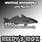 Bulk whiting rig Save on fishing rigs with circle hooks
bulk buy pre-made whiting rig with circle hooks flasher rig awesome for king gorgre sand whiting .shop online cheap prices through ebay tackle store.

Snapper Rig Paternoster Bulk Flasher rigs Premade .
Snapper Fishing Rigs Great For Bottom Reef Fishing Stock up For sydney Snapper Offshore Bottom bouncing
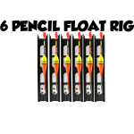 Float rig garfish mullet fishing rig pencil float rigs.
Float Rigs Tied For Garfish & Catching Fresh Bait stock Browse our range of Pencil floats rigs
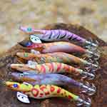
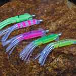 25 squid skirts lures game teaser’s trolling offshore
Trolling skirt pack of bulk lure offshore fishing game skirt jig – snapper tackle australian tackle shop online cheap fishing gear at wholesale Price.
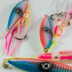 Snapper Micro jig -bulk snapper lure slow pitch fishing.
slow pitch jigs micro jig octoc jigging with slow pitch range of snapper lures save on wholsale japanse fishing tackle products shop by brands
bulk squid jig egi fishing jigs japanse fishing
squid jig for egi fishing bluk lots save moeny shop online for cheap squid jigs by snapper fishing tackle store on ebay wholesale lure baits rig.
–
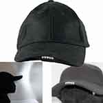 Led Workmen Hat with Tourch in cap fishing
Fishing hats workmen Led snapper back hat bulit in to see in the dark better then a touch . see our range of fishing clothes trusted brands banndana

bandana fishing apparel neck sock Scarves & Neck Gaitor
bandana fishing apparel neck sock Scarves & Neck Gaitors Snapper Fishing Tackle Wholsale online Shop -Shimano fishing Reels- Snapper Bandana’s
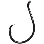
Snapper Rig circle hooks 5/0 rig flasher rigs for Pre Made
circle hooks 5/0 6/0 7/0 8/0 fishing rig on a paternoster bait jig combo . great fishing rig for snapper bulk packs of gamma circle hooks save dollars
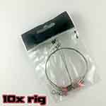 Wire fishing rig Trace Leader Rigs shark fishing
Shark wire trace leader fishing rig for toothy shark critters strong leader 10x Wire fishing rig Trace Leader Rigs Tackle Lure Swivel toothy Mackeal arms